3D RECONSTRUCTION OF
CONSTRUCTION SITES
With 2Freedom V1.0 it is possible to document construction sites in the urban environment very quickly and accurately.

DIFFERENT PHASES
It is really a very useful method to document the different phases of a construction site for monitoring, to calculate earthworks or to produce 2D/3D plans of each phase. 3D measurements, contour maps, etc. can be made.
CADASTRE
The use of the 2Freedom V1.0 scanner is a very useful tool for cadastral measurements. This instrument is compact, light, flexible and the data capture is very fast and accurate. On the other hand, the scanner has impressive photorealistic textures. It is therefore ideal for cadastral measurements.
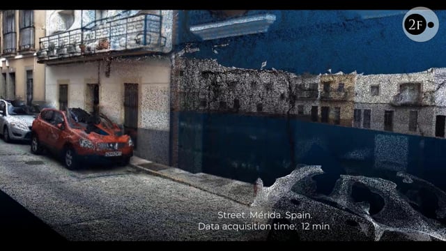
URBAN PLANNING PROJECTS
2freedom can document streets, pavements, parks, crossroads, roundabouts, etc. Its ease of use means that it can be used by different people within a company or institution, without the need for prior knowledge of 3D scanners. The scanned data can be used for measurements, volume calculations, 2D/3D plans, etc. and can be a fundamental tool for scanning the current state of the terrain and planning future works, budgets or urban development projects.
MAPPING WITH DRONES
2freedom technology, through the processing app, can create 3D maps using drone videos and can therefore generate plans of large urban or rustic extensions.

MORE THINGS YOU CAN DO
WITH 2FREEDOM V1.0


Want to know more?
Contact us