Combining the 2Freedom scanner, drone camera and mobile phones.
We like to state clearly that the 2Freedom scanner is a philosophy in the way we measure and document. A philosophy based on flexibility and freedom. Until now, documenting a small object required a short range 3D scanner; scanning an archaeological site, for example, required a medium range scanner and for aerial captures a drone was needed to do photogrammetry or implement a Lidar. The combination of these techniques was and is neither simple nor cheap.
Our proposal is to use 2Freedom technology to make life easier for people who need to make measurements and graphic documentation. Therefore
1. We use the 2Freedom V1.0 scanner to scan objects from 20 or 30 centimetres up to 30 metres. Buildings, parks, archaeological sites, hillsides, constructions, etc. The 2Freedom scanner can achieve detail capable of discerning below a millimetre, and can be accurate to within 1 mm if the camera is zoomed to the maximum distance, provided it is in focus.
A 2 to 4 metre pole can be used to scan high areas, such as ledges or roofs, or simply to get a better angle and a wider view if you want to capture pavements and terrain.

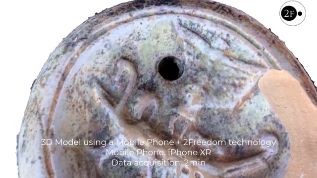
2. We use a mobile phone to zoom in on objects that require high precision and a short scanning distance: small archaeological artefacts, precision ornaments or bas-reliefs, carved surfaces, etc. – although the mobile phone or another video camera can also be used for larger objects-. With a simple video, the object to be scanned is recorded and then opened and processed with the 2Freedom 3D Process application, which generates a 3D model automatically from the video. It is therefore a very simple, fast and intuitive process.
We can integrate the scanned data taken with the 2Freedom Scanner with the videos recorded with the mobile phone. Both captures must have a certain common area with a similar perspective; both scans are processed together with the 2Freedom Process 3D software and a single 3D model is obtained, if desired.
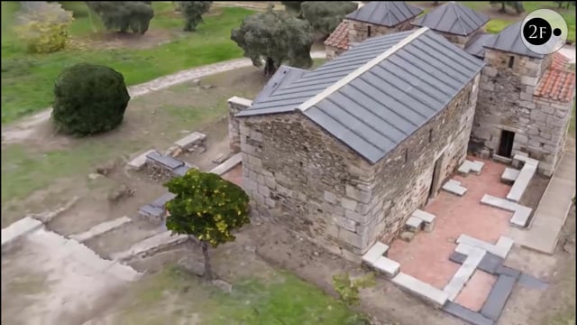
1. For larger overhead captures or those that require a greater height, we use the drone to record a video of the area or areas to be scanned. All kinds of data can be captured from the drone and the video or videos generated will be processed with the 2Freedom Process 3D application to generate a 3D model. This is very useful for aerial captures of buildings, urban areas, accident zones, etc… and no other scanner is needed to complete the data from the ground, beyond the 2Freedom V1.0 scanner.
Therefore, 2Freedom is not only the first videogrammetric camera on the market, but it is, above all, a new capture philosophy.