What is photogrammetry?
Podemos decir que la fotogrametría es la técnica que permite obtener información tridimensional de un objeto o espacio a partir de fotografías. Ahora bien, ¿qué es la fotogrametría exactamente y cuáles son sus alcances?
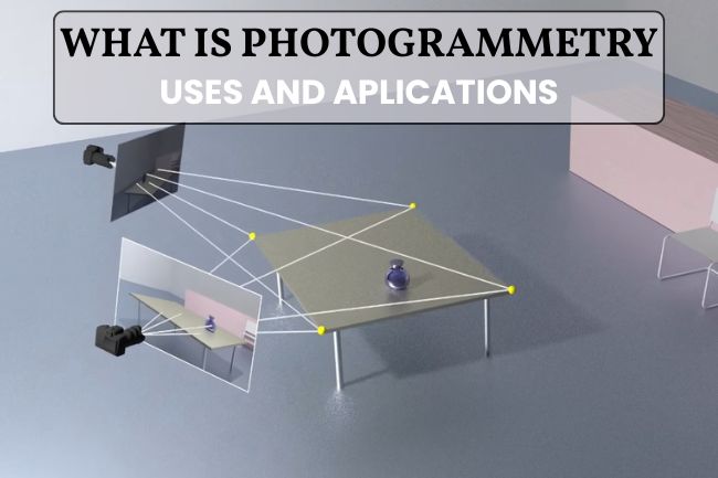
La fotogrametría es el proceso de obtener información métrica y geométrica a partir de imágenes tomadas desde distintos ángulos, para crear planos, mapas o modelos digitales detallados y precisos.
Se trata de una tecnología muy utilizada en diversas industrias, desde la topografía hasta la arqueología, por lo que ha revolucionado la forma en que capturamos y analizamos el espacio tridimensional.
En este post, exploraremos en profundidad qué es la fotogrametría, sus aplicaciones, ventajas y el proceso detrás de esta fascinante técnica.
Table of contents
History and evolution of photogrammetry
La fotogrametría no es una disciplina nueva. Por el contrario, sus orígenes se remontan al siglo XIX, cuando los pioneros comenzaron a utilizar fotografías aéreas para mapear terrenos de grandes extensiones.
Con el tiempo, los avances en tecnología fotográfica y computacional han permitido que la fotogrametría evolucione a grandes saltos. De ser una técnica manual y laboriosa, se transformó en un proceso automatizado y altamente preciso.
Initial process
En sus inicios, la fotogrametría requería un trabajo arduo de interpretación manual de fotografías, donde se utilizaban estereoscopios para ver imágenes dobles y calcular las dimensiones y distancias.
Con la llegada de las computadoras y su desarrollo tecnológico, este proceso se simplificó y se volvió más preciso, permitiendo un análisis más detallado y rápido de las imágenes.
How does photogrammetry work?
La fotogrametría se basa en el principio de que un objeto puede ser reconstruido tridimensionalmente a partir de múltiples imágenes bidimensionales, que son tomadas desde diferentes ángulos. Este principio es similar al de la visión estereoscópica humana, donde el cerebro utiliza las diferencias de perspectiva entre los dos ojos para percibir la profundidad.
If you have doubts between the different techniques, in another post we explain the main differences between videogrammetry and photogrammetry.
Types of photogrammetry
La fotogrametría se clasifica principalmente según el punto desde donde se toman las imágenes. Cada tipo tiene aplicaciones concretas y ventajas específicas:
Aerial photogrammetry
Se realiza desde plataformas elevadas como drones, aviones o satélites. Es la más utilizada para obtener una visión global de grandes áreas, porque permite elaborar mapas topográficos, modelos digitales del terreno y ortofotos con gran precisión
Terrestrial Photogrammetry
Consiste en capturar imágenes a nivel del suelo mediante cámaras convencionales o escáneres montados en trípodes, vehículos o incluso manualmente. Se emplea en arquitectura, ingeniería civil, arqueología y patrimonio.
Aerial photogrammetry
La fotogrametría tiene una amplia gama de aplicaciones en diversos campos, tales como:
Surveying and cartography
La fotogrametría es utilizada para crear mapas topográficos precisos, permitiendo a los topógrafos medir y analizar terrenos con gran detalle sin necesidad de visitar físicamente el lugar.
Architecture and engineering
En la arquitectura, se utiliza para crear modelos 3D de edificios, lo que facilita la planificación y restauración de la obra. Mientras que en ingeniería se emplea para inspeccionar el estado de infraestructuras, como puentes y carreteras.
Archeology
Los arqueólogos utilizan la fotogrametría para documentar y analizar yacimientos arqueológicos o recuperación de patrimonio, permitiendo una conservación digital precisa de sitios históricos que pueden ser frágiles o en todo caso inaccesibles.
Entertainment industry
En el cine y los videojuegos, esta técnica se utiliza para crear entornos y personajes virtuales realistas, logrando una mayor la calidad visual de las producciones.
Advantages of photogrammetry
-
- Accuracy and detail: it is undeniable that photogrammetry offers millimeter precision in measuring objects and terrain.
- Efficiency: enables rapid and detailed analysis without the need for extensive fieldwork.
- Versatility: it can be applied in multiple industries and for multiple purposes, from mapping to digital content creation.
- Cost-effectiveness: it is often more economical than other three-dimensional measurement techniques, such as laser scanning.
-
- Image quality: The accuracy of the 3D model still depends largely on the quality and quantity of the photographs captured.
- Environmental conditions: factors such as lighting and weather can affect image quality and, therefore, the final model.
- Computational complexity: Processing large volumes of data to create three-dimensional models can be computationally demanding and intensive.
The future of photogrammetry
Con los avances continuos en inteligencia artificial y tecnología de drones, el futuro de la fotogrametría promete ser aún más sofisticado y emocionante.
Por ejemplo, se espera que el uso de drones para capturar imágenes aéreas mejore la eficiencia y cobertura, mientras que la inteligencia artificial ayude a automatizar y mejorar la precisión del procesamiento de imágenes.
Otro elemento a considerar sobre el futuro de la fotogrametría es ya presente, hablamos de la videogrametría y de cómo está sustituyendo esta tecnología muchos ámbitos de la fotogrametría actual gracias al software 2fvideomodeling. De la misma manera, debemos de mencionar la existencia de un escáner 3D portátil: 2fSLAM y también el cómo la videogrametría interacciona con sistemas de medición GNSS-RTK y estaciones totales, en productos como 2fImaging.
Conclusion
Ciertamente, la fotogrametría es una herramienta poderosa que ha transformado nuestra capacidad para capturar y analizar el mundo en tres dimensiones.
La aplicación exitosa que ha tenido en diversas industrias no solo ha mejorado la precisión y eficiencia de numerosos procesos, sino que también ha abierto nuevas posibilidades para la innovación y el descubrimiento constantes.
Si requieres de equipos versátiles y precisos de fotogrametría para el desarrollo de tus proyectos profesionales, nuestra empresa de digitalización 3D cuenta con los equipos más completos y sofisticados del mercado, garantizando así un buen trabajo de análisis espacial en tres dimensiones.
What is photogrammetry used for?
It is used to generate accurate maps, plans, and digital representations in fields such as surveying, architecture, and archaeology.
What is required to perform photogrammetry?
Cameras (ground-based, aerial, or drone), specialized software, and reference points are required to process and georeference the images.
What does a photogrammetrist do?
This professional captures, processes, and analyzes photographs to convert them into metric data, 3D models, or maps that are useful in various projects.
What are the types of photogrammetry?
There are mainly two types: aerial, carried out with drones or aircraft, and terrestrial, carried out from the ground with conventional cameras or scanners.
Challenges and limitations
A pesar de sus muchas ventajas, la fotogrametría también enfrenta ciertos desafíos que detallamos a continuación: